


Northwest Missouri PUMA, Missouri
About
Outline

Summary
| Unique Area Identifier | 193272 |
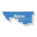
| Name | Northwest Missouri PUMA |
| State | Missouri |
| Area (square miles) | 7,176.54 |
| Land Area (square miles) | 7,133.04 |
| Water Area (square miles) | 43.50 |
| % of Land Area | 99.39 |
| % of Water Area | 0.61 |
| Latitude of the Internal Point | 40.21247220 |
| Longtitude of the Internal Point | -94.02051970 |
Maps


Graphs
Select a template below for downloading or customizing gragh for Northwest Missouri PUMA, Missouri


Neighbors
Neighoring Public Use Microdata Area (by Name) Neighboring Public Use Microdata Area on the Map
- Buchanan, Andrew & DeKalb Counties PUMA, MO
- Johnson, Lafayette, Ray, Clinton & Caldwell Counties PUMA, MO
- Northeast Kansas PUMA, KS
- Northeast Missouri PUMA, MO
- Pettis, Randolph, Saline, Cooper, Howard, Carroll & Chariton Counties PUMA, MO
- South Central Iowa PUMA, IA
- Southeast Nebraska PUMA, NE
- Southwest Iowa--Council Bluffs City PUMA, IA
Top 10 Neighboring County (by Population) Neighboring County on the Map
- Adair County, MO (25,607)
- Nodaway County, MO (23,370)
- Andrew County, MO (17,291)
- Page County, IA (15,932)
- Otoe County, NE (15,740)
- Macon County, MO (15,566)
- Livingston County, MO (15,195)
- DeKalb County, MO (12,892)
- Appanoose County, IA (12,887)
- Linn County, MO (12,761)
Top 10 Neighboring County Subdivision (by Population) Neighboring County Subdivision on the Map
- Polk township, Nodaway County, MO (15,777)
- Chillicothe township, Livingston County, MO (9,732)
- Trenton township, Grundy County, MO (6,393)
- Grand River township, DeKalb County, MO (5,893)
- Brookfield township, Linn County, MO (5,208)
- Bethany township, Harrison County, MO (3,674)
- Polk township, Sullivan County, MO (2,910)
- Marceline township, Linn County, MO (2,693)
- Hamilton township, Caldwell County, MO (2,382)
- Athens township, Gentry County, MO (2,178)
Top 10 Neighboring Place (by Population) Neighboring Place on the Map
- Maryville city, MO (11,972)
- Chillicothe city, MO (9,515)
- Trenton city, MO (6,001)
- Brookfield city, MO (4,542)
- Bethany city, MO (3,292)
- Marceline city, MO (2,233)
- Milan city, MO (1,960)
- Unionville city, MO (1,865)
- Gallatin city, MO (1,786)
- Albany city, MO (1,730)
Top 10 Neighboring Elementary School District (by Population) Neighboring Elementary School District on the Map
- Livingston County R-III School District, MO (622)
- Spickard R-II School District, MO (589)
- Laredo R-VII School District, MO (481)
- Pleasant View R-VI School District, MO (449)
Top 10 Neighboring Unified School District (by Population) Neighboring Unified School District on the Map
- Kirksville R-III School District, MO (22,063)
- Maryville R-II Schools, MO (15,911)
- Savannah R-III School District, MO (13,635)
- Cameron R-I School District, MO (13,070)
- Chillicothe R-II School District, MO (12,889)
- Nebraska City Public Schools, NE (9,241)
- Centerville Community School District, IA (9,212)
- Trenton R-IX School District, MO (7,824)
- Brookfield R-III School District, MO (6,503)
- Shenandoah Community School District, IA (6,281)
Top 10 Neighboring State Legislative District Lower Chamber (by Population) Neighboring State Legislative District Lower Chamber on the Map
- State House District 28, MO (38,291)
- State House District 5, MO (38,074)
- State House District 3, MO (35,529)
- State House District 4, MO (35,512)
- State House District 2, MO (35,389)
- State House District 7, MO (34,548)
- State House District 22, MO (34,437)
- State House District 1, MO (33,818)
- State House District 8, MO (33,540)
- State House District 95, IA (29,515)
Top 10 Neighboring State Legislative District Upper Chamber (by Population) Neighboring State Legislative District Upper Chamber on the Map
- State Senate District 12, MO (169,332)
- State Senate District 21, MO (163,305)
- State Senate District 18, MO (159,547)
- State Senate District 1, KS (69,919)
- State Senate District 49, IA (60,560)
- State Senate District 47, IA (57,346)
- State Senate District 48, IA (56,494)
- State Senate District 1, NE (33,429)
Top 10 Neighboring 111th Congressional District (by Population) Neighboring 111th Congressional District on the Map
- Congressional District 2, KS (710,047)
- Congressional District 6, MO (693,974)
- Congressional District 9, MO (684,101)
- Congressional District 1, NE (626,092)
- Congressional District 2, IA (620,856)
- Congressional District 5, IA (577,453)
Top 10 Neighboring Census Tract (by Population) Neighboring Census Tract on the Map
- Census Tract 801, DeKalb County, MO (8,900)
- Census Tract 4703, Nodaway County, MO (8,415)
- Census Tract 9502, Caldwell County, MO (6,485)
- Census Tract 4705, Nodaway County, MO (5,474)
- Census Tract 4702, Daviess County, MO (4,990)
- Census Tract 4704, Nodaway County, MO (4,262)
- Census Tract 802, DeKalb County, MO (3,992)
- Census Tract 9602, Decatur County, IA (3,826)
- Census Tract 9602, Gentry County, MO (3,746)
- Census Tract 4801, Livingston County, MO (3,652)
Top 10 Neighboring 5-Digit ZIP Code Tabulation Area (by Population) Neighboring 5-Digit ZIP Code Tabulation Area on the Map
- 64468, MO (16,023)
- 64429, MO (13,158)
- 64601, MO (12,438)
- 68410, NE (8,716)
- 64683, MO (8,144)
- 64485, MO (8,124)
- 52544, IA (7,847)
- 64628, MO (6,144)
- 68355, NE (5,113)
- 64424, MO (4,585)